LET'S RECONNECT DOWNTOWN TO THE RIVERFRONT.
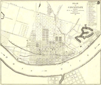
 City Incorporation Plan (1819)
Early Cincinnati hugged the riverfront, which was a vital commerce and transportation depot in the nation's western frontier.
By 1855, river transportation had helped transform Cincinnati into the sixth-largest city in the United States. The city's booming population largely remained in the urban basin surrounded by hillsides for the next 30 years.
With the rise of electric streetcars and cable cars in the 1880s, travel to hilltop communities became easier for Cincinnati's residents, who spread more than 10 miles from the original city core.
As a result of residents' migration out to streetcar suburbs, and the periodic flooding of the Ohio River, the 1925 City Plan largely wrote off the riverfront for housing and proposed no infrastructure improvements to the area.
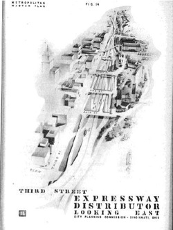
'THIRD STREET DISTRIBUTOR' & FORT WASHINGTON WAY

By the 1930s, automobiles had joined streetcars on Cincinnati's now-crowded roadways. To accommodate more and more personal automobiles, the 1936 Thoroughfare Plan identified the need to improve Second, Third and Fifth Streets as elevated structures for access for downtown from the east.
After the Great Flood of 1937, the River Front Revitalization Plan proposed the Third Street Distributor as a flood-free route from the east into downtown.
The 1948 Master Plan & 1949 Motorway Plan continued the calls for an expressway between downtown and the river. They also proposed the complete redevelopment of the riverfront, with a baseball park and a proposed flood-proofed government center, and token housing developed by the private sector.
The Third Street Distributor, completed in the late 1950s, did allow automobiles to zoom in and out of downtown. But it also cut the city off from its river, which had been one of its defining features for more than a century.
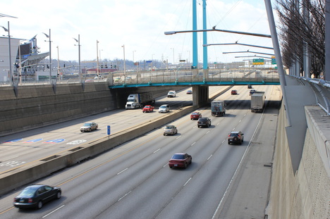
PRESENT DAY: FORT WASHINGTON WAY

Aside from a stadium and one residential tower, riverfront redevelopment envisioned by the 1948 Master Plan had not been realized.
By the late 1990s, residents, local and state leaders, and the business community recognized that the area surrounding the Third Street Distributor needed to be fixed -- importantly, by narrowing the freeway's footprint and reconnecting the city to the river.
When construction on the new Fort Washington Way was completed in the early 2000s, the gap between Downtown and the Riverfront was narrowed, but not eliminated.
During the renovation, pilings were placed in the ground to be used as supports for a future elevated surface over the highway.
The current chasm between Second and Third streets creates a significant visual and physical disconnect that needs to be fixed to have a continuous urban landscape. Central riverfront development known as The Banks and Smale Riverfront Park is currently underway. However, that development is severed from the Central Business District by
the Fort Washington Way highway trench.
The decks over Fort Washington Way will cover the recessed highway, at street level between Second and Third Streets, book-ended by Elm Street to the west and Main Street to the east.
Successful completion of decks will finally connect Cincinnati’s Central Business District to the Central Riverfront -- something that hasn't existed in nearly 60 years.

